Why Geography Matters in the Citizenship Test
Geography is one of the core topics of the Swiss naturalization test. Alongside politics, history and Swiss society, almost every cantonal exam asks you to place the country: where Switzerland lies, which countries it borders, which regions and mountains define it, and which rivers and lakes you should be able to name. These are exactly the kinds of facts that come up again and again, because they are objective, easy to phrase as a multiple-choice question, and considered basic knowledge for living in the country.
The good news is that geography is one of the most learnable parts of the whole exam. Unlike abstract questions about direct democracy or the three-pillar pension system, geographical facts are concrete and visual. A handful of numbers and names — the five neighbours, the three main regions, the highest peak, the longest river, the largest lake — covers most of what you will be asked. Once those stick, you rarely lose points here.
The geography questions belong to the federal part of the test, the part that is the same for everyone regardless of canton. This federal knowledge is the foundation that the cantonal questions build on. If you want to understand how the federal and cantonal portions fit together and how the test is scored, read our explainer on the Grundkenntnistest.
In this guide we organise the geography of Switzerland so it actually sticks: first the location and the big regions, then the mountains, then the rivers and lakes, and finally the cantons and language regions. Each section is built around the facts most likely to appear on your test. For a broader look at the question types you will face, see our overview of test questions.
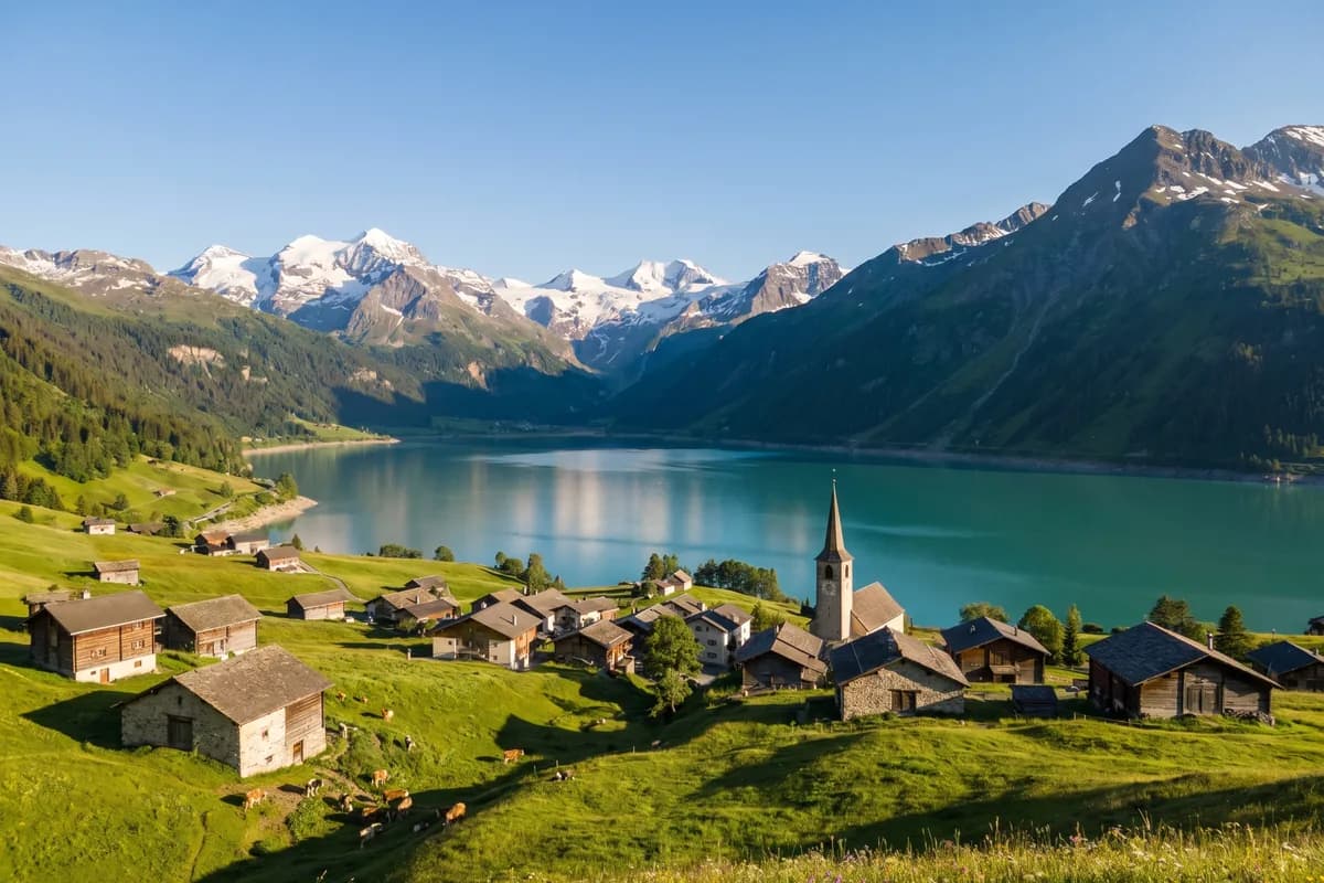
Location, Neighbours and the Main Regions
Start with the basics, because they are the most common questions of all. Switzerland is a landlocked country in Central Europe — it has no coastline and no access to the sea. Its total area is roughly 41'285 km², which makes it one of the smaller countries in Europe, and it is home to a population of about 8.9 million people.
Switzerland borders five countries. Going clockwise, they are Germany to the north, Austria and the Principality of Liechtenstein to the east, Italy to the south, and France to the west. A useful memory hook: four of the neighbours are large states (Germany, France, Italy, Austria) and one is a tiny principality (Liechtenstein). Liechtenstein is the one applicants most often forget, so make a point of remembering it.
Geographically, the country divides into three main regions. From north-west to south-east, they are:
- The Jura — a folded mountain range along the border with France, lower and gentler than the Alps, in the north-west of the country.
- The Mittelland (Central Plateau) — the hilly lowland belt between the Jura and the Alps. This is where most Swiss people live and where the biggest cities, including Zürich, Bern, Basel, Lausanne and Geneva, are located.
- The Alps — the high mountains in the south and centre, covering roughly 60% of the country's surface. They contain the highest peaks and feed the major rivers and lakes.
Knowing these three regions in order, and remembering that the Mittelland holds most of the population while the Alps cover most of the land, answers a large share of the geography questions on its own.
The Mountains of Switzerland
The Alps are the heart of Swiss geography, and a few peaks come up so often that they are worth memorising by name and, ideally, by height. The single fact most likely to appear is the highest mountain in Switzerland: the Dufourspitze, part of the Monte Rosa massif on the border with Italy in the canton of Valais, at 4'634 m.
The most famous and most photographed mountain, however, is the Matterhorn (4'478 m), the pyramid-shaped peak above Zermatt in Valais. It is iconic enough that a question may treat it as a symbol of Switzerland rather than as its highest point — so do not confuse the most famous mountain with the highest one. These are the peaks worth knowing:
- Dufourspitze — 4'634 m, the highest mountain in Switzerland, in the Monte Rosa massif (Valais).
- Matterhorn — 4'478 m, the iconic pyramid above Zermatt (Valais).
- Jungfrau — about 4'158 m, in the Bernese Alps, part of the famous Eiger–Mönch–Jungfrau trio.
- Eiger — about 3'967 m, known worldwide for its steep north face.
- Mönch — about 4'107 m, standing between the Eiger and the Jungfrau.
Beyond individual peaks, one place name carries special weight: the Gotthard. The Gotthard massif in the central Alps is a key axis of the country, both as a historic Alpine pass and as the route of major road and rail tunnels linking the north and south of Switzerland. The Gotthard region is also where several important rivers rise, which connects the mountains directly to the next topic.
Rivers and Lakes
Switzerland is often called the "water tower of Europe" because several of the continent's great rivers rise in its Alps. Two are especially important to know: the Rhine (Rhein) and the Rhône, which both have their source in the Swiss Alps and then flow on to the sea through other countries. Within Switzerland itself, the longest river is the Aare — it is the longest river that runs entirely inside the country. These are the rivers worth remembering:
- The Rhine (Rhein) — rises in the Swiss Alps (Graubünden) and flows north, forming part of the border with Germany before continuing to the North Sea.
- The Rhône — rises in the Valais Alps, flows through Lake Geneva, and continues into France towards the Mediterranean.
- The Aare — the longest river entirely within Switzerland; it flows past Bern before joining the Rhine.
- The Reuss — flows from the Gotthard region through Lake Lucerne.
- The Limmat — flows out of Lake Zürich through the city of Zürich.
- The Ticino — gives its name to the southern canton and flows towards the Po in Italy.
- The Inn — rises in the Engadin (Graubünden) and flows east towards the Danube.
The lakes are just as testable, and a few superlatives come up repeatedly. The largest lake is Lake Geneva (Genfersee / Lac Léman), shared with France. The lowest point of Switzerland lies on the shore of Lago Maggiore, at about 193 m above sea level. Lake Neuchâtel is the largest lake lying entirely within Switzerland. Keep these lakes in mind:
- Lake Geneva (Genfersee / Lac Léman) — the largest lake in Switzerland, shared with France.
- Lake Constance (Bodensee) — in the north-east, shared with Germany and Austria.
- Lago Maggiore — in Ticino; its shore is the lowest point of Switzerland (~193 m).
- Lake Neuchâtel — the largest lake entirely within Switzerland.
- Lake Zürich — in the Mittelland, beside the country's largest city.
- Lake Lucerne (Vierwaldstättersee) — in central Switzerland, linked to the founding history of the Confederation.
Cantons and Language Regions
The political map of Switzerland is built on its cantons. The country is a federal state made up of 26 cantons, each with its own constitution, government and parliament. Knowing that there are exactly 26 of them — and being able to name your own canton and its capital — is essential test knowledge. For the full list of all cantons with their capitals and abbreviations, see our reference list of cantons and capitals, and you can browse each one in our canton overview.
Closely tied to the cantons are the four language regions. Switzerland has four national languages, and the language of a region usually follows the map:
- German — the most widely spoken language, used across most of central, northern and eastern Switzerland.
- French — spoken in the west (Romandy), in cantons such as Geneva, Vaud, Neuchâtel and Jura.
- Italian — spoken in the south, mainly in the canton of Ticino and parts of Graubünden.
- Romansh — the smallest of the four, spoken in parts of the canton of Graubünden; it is a national language and an official language for dealings with Romansh speakers.
A detail that often surprises applicants: Graubünden is the only canton with three official languages (German, Italian and Romansh), while a few cantons such as Bern, Fribourg and Valais are officially bilingual. Romansh is the language candidates most often forget when asked to list the four national languages, so commit it to memory.
When you combine the cantons with the language regions, you can answer the classic questions confidently: how many cantons there are, which languages are national languages, and roughly where each language is spoken. This is the bridge between the physical geography of mountains and rivers and the political geography the test cares about.
Everything in one book
See the handbookHow to Learn Swiss Geography Efficiently
Geography rewards a visual, structured approach, so do not just read lists — anchor them to a map in your head. Picture Switzerland with the Jura in the north-west, the Mittelland through the middle, and the Alps filling the south. Place the five neighbours around the edge, drop in the highest peak and the most famous one, and trace the Rhine flowing north and the Rhône flowing west through Lake Geneva. When facts hang on a mental map like this, they stay put far better than a memorised list ever could.
Then turn reading into practice. The most efficient method is to learn a block of facts, then immediately test yourself with exam-style questions on that exact block — location and neighbours first, then mountains, then rivers and lakes, then cantons and languages. Spaced repetition, reviewing the facts you keep getting wrong, is what moves them into long-term memory before test day. Our overview of test questions shows the format these questions take so there are no surprises in the exam room.
This is exactly where a structured handbook saves you time. Our complete handbook lays out the geography of Switzerland as a clear curriculum — the regions, mountains, rivers, lakes, cantons and language regions explained with the context you need — and then gives you practice questions with full explanations so you learn the fact behind each answer, not just the letter. Everything sits in one place, works offline, and covers all 26 cantons, so you are not stitching together scattered PDFs and brochures. If you are weighing up your options, our comparison of study material explains why a single structured resource usually beats a pile of free fragments.
The bottom line: Swiss geography is one of the most scoreable topics on the naturalization test, because the facts are concrete and finite. Learn the location and the three regions, a handful of peaks, the main rivers and lakes, and the 26 cantons with their four language regions — practise them on a map and with real questions — and you will walk into this part of the exam expecting to get every point. Build that knowledge on a structured foundation and the rest of your preparation gets easier too.
Everything in one book
See the handbook